Hiking tour

Matonkopf

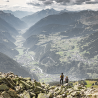
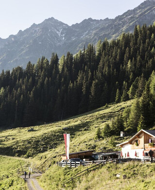
The start is in the district of Übersachsen, which can be easily reached by car. At the hamlet of Übersachsen you can enjoy the beautiful view over the Oberinntal valley. From Übersachsen it takes about 2 hours to walk to the Matonkopf. The path is partly flat, partly uphill and continues to the Langhaus and across the ‘Fadele-Wiesen’ meadows to the Langezberg shepherd's hut. At the hut, a somewhat steep path (marked with red dots on the stones) leads to the left to the Matonkopf. From there you have a very beautiful view!
tour1
4.5:0h
802m
8.8km
Highest point
2150m
Start point
Übersachsen Tösens
End point
Übersachsen Tösens

Similar Tours

Difficult
792m | 3.6km
Easy
150m | 4h
Hiking tour
Mösle - Pflanzgareten - Sclamishot
Begin: Nauders
End: Martinsbruck
Difficult
839m | 8.5h | 7.7km
Hiking tour
Goaßpleisenkopf über Gamor
Begin: Pfarrkirche Nauders
End: Nauders
Medium
753m | 6.5h | 12.4km
Hiking tour
Höhenweg Dreiländergrenzstein
End: Gasthof Martha
Medium
413m | 5h | 5.44km
Hiking tour
Anton-Renk-Hütte (2.261 m)
Begin: Sattelklause
End: Anton-Renk-Hütte (2.260 m)
Medium
475m | 6h | 11.7km
Hiking tour
Nach Pfunds von der Labaunalm
Begin: Labaunalm
End: Pfunds Dorf
Easy
426m | 3.5h | 7.5km
Hiking tour
Sellesköpfe
Begin: Lochmühle
End: Mutzkopf Talstation
Difficult
609m | 4h | 5.8km
Hiking tour
Zaunhof - Kaunerberg
Begin: Zaunhof
End: Kaunerberg